
Exploring old trails in Rakitnica canyon
-
7th April, 2016
What I love about Rakitnica canyon is that there are so many old trails, which have been mostly forgotten in the last 25 years, and we get to re-explore them. Usually during summer all these trails are hidden by lush greenery and spiky shrubs. As the spring arrived, melted the snow, and the greenery still didn't have time to recover, we used the time to explore some of the most beautiful hiking spots around Sarajevo.
Today we had a guest with us, a travel blogger Zana Jaganjac (www.worldofatravelholic.com), based in Kopenhagen, so a perfect company to explore one of the deepest canyons in Europe!
Just like the last time, the hike started from Umoljani highland village, to tell the legend of the village to our guest. After seeing Aždaha, the stone serpent, we climbed to Gradina summer village.

Studeni potok is still flowing and still curvy. But this time we're not here to enjoy the calm stream. We will be descending down to see the last waterfall it makes before becoming part of Rakitnica. The trail follows the trail for Lukomir highland village, but soon makes a turn downwards. We descended down into the canyon from the end of Papratni do. An unmarked trail is leading towards a waterfall in a cave. Unseen to many, this is one of the hidden gems the canyon offers to its visitors. The waterfall starts from the roof of the cave and falls down and then outside.

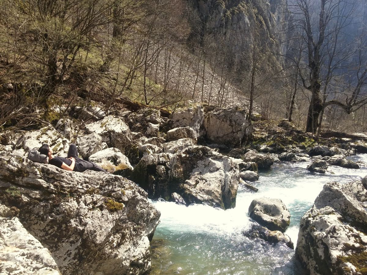
The waterfall is only half way down. Another half through the forest, and we're next to the river. We decided to take a long break and sunbathe for an hour at Đuro's bridge, one of only two small hanging bridges across Rakitnica. This is the place where five trails meet: towards Dolovi/Umoljani, Bobovica, Lukomir, Gradina and Džehennem. "Bobovica - Lukomir highway" for example is a goat trail over cliffs on Visočica side of the canyon and a barely-able-to-be-seen-unmarked-trail on Bjelašnica side toward Peruće waterfall and finally ends in Lukomir. Other trail follows the canyon, and goes from the entrance towards Džehennem (english: Hell), which is the narrowest part of the canyon.
After the break, it's time to go home. We decided to make a circle by hiking towards the entrance of the canyon and then over pastures to the eight mills of Umoljani where our car is waiting. But on our way we encountered a pretty large water snake (Natrix natrix), which has just eaten something (a frog probably).

Before exiting the canyon we saw one more waterfall. The final waterfall of many that Studeni potok makes before merging with Rakitnica river. Soon after, we got out of canyon, made a last stop at eight mills of Umoljani, before arriving to our starting point.

The trip is only 9,66 kilometers, but as the terrain is very hard and it's not recommended for those who are not fit. Hiking boots are a must, and hiking poles are reccomended. In the end we stopped at Dolovi necropolis to see the magnificent last resting place of medieval residents of Umoljani.
Visit Zana's amazing blog and instagram profile!
For more info about this trip: Rakitnica canyon hike
For more photos from this and other trips - follow us on instagram!
To see what we're up to, and join one of our trips - follow us on facebook!